Day 2: Sitosjaure – Aktse: 13km +300m/-430m
5AM, awake, sun is showing slowly up… Ghrmuuh! Too early, turning back to sleep. But it doesn’t really work… Why can’t I sleep correctly ?? Oh yeah, we went to bed at 8 yesterday… Whatever, 6AM, breakfast time. The fire was good enough last night, and is not completely dead this morning. Nice feeling! The outside thermometer however is saying something I try not to believe… Brr! Try not to think about it, eat a maximum of the breakfast (==> Carrying less!), putting on all the warm clothes, and rushing out. 8AM, we’re out, ready to rock the road again, the sun is helping!
The plan of today is quite simple: Short stage (13km), with 4km crossing the first lake, 5km going up the hill (300m up), and 4 down to the next cottage, nearby another big lake. The plan of today is quite simple, … too simple!It would just take us a couple of hours. The weather is incredible, we have to enjoy it as much as possible! I’ve heard about a small peak somewhere nearby the path, out of the main road, called Skierffe, right inside the Sarek national park. Doesn’t look that far from our road (OK, I know it’s a 15 extra km, but everybody in the group doesn’t need to know that!). We’ll see depending on the motivation.
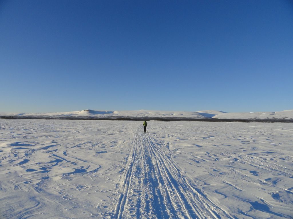
We are starting quite fast on the lake, to warm up. Each picture cost my hands 5 minutes to get warm again… Go on! After 20 minutes, picture break, but also clothes break. With the sun and the effort, we put too much clothes on… sweating… removing half of it… sweating a bit less… keeping the jacket open…feeling fresh and nice cold air … freezing!!!! Let’s hit the road again!! The passage on the lake is easy and beautiful. On the other side, 3km in a birch forest take us up slowly to the tree limit. We’ll see (pretty close actually) our first rock ptarmigans (lagopèdes alpins) of the trip. Looking behind, the cottages from this morning looks so far away. The view over the whole valley is beautiful!
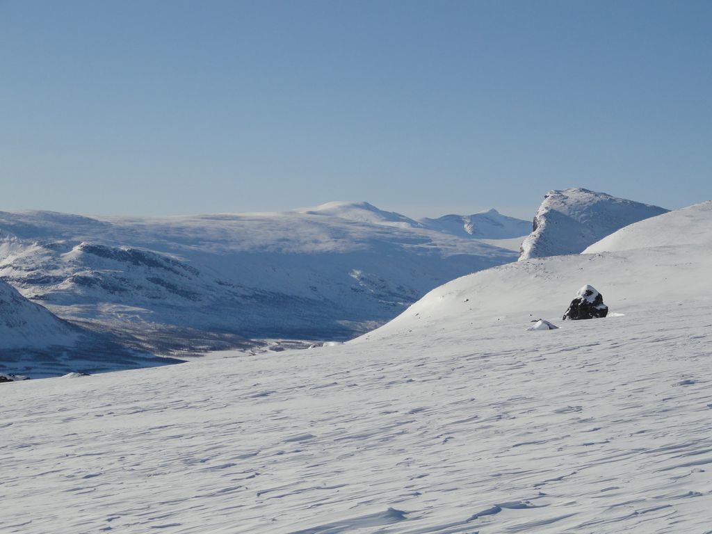
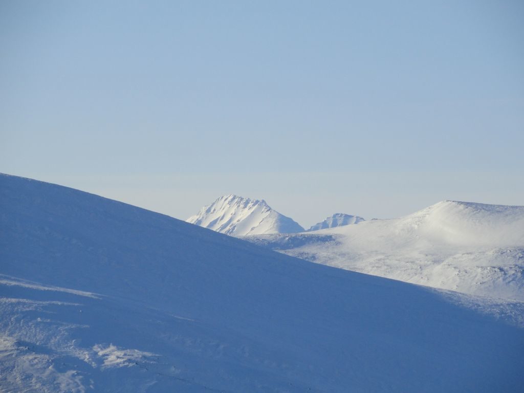
At the tree limit, a quite steep slope is waiting for us, the last 200m for the day… Or at least from the marked path… A bit slippery and icy. For sure the toughest part of the week! Up this hill (920m), it is the highest point of the marked trail. Motivation is good, we decide to give a shot towards Skierffe, that we’re seeing, far away in front of us. We’ll go for an hour facing it, but it does not seems to get any closer. 1PM, quick lunch (remember, cold!) at the perfect spot.
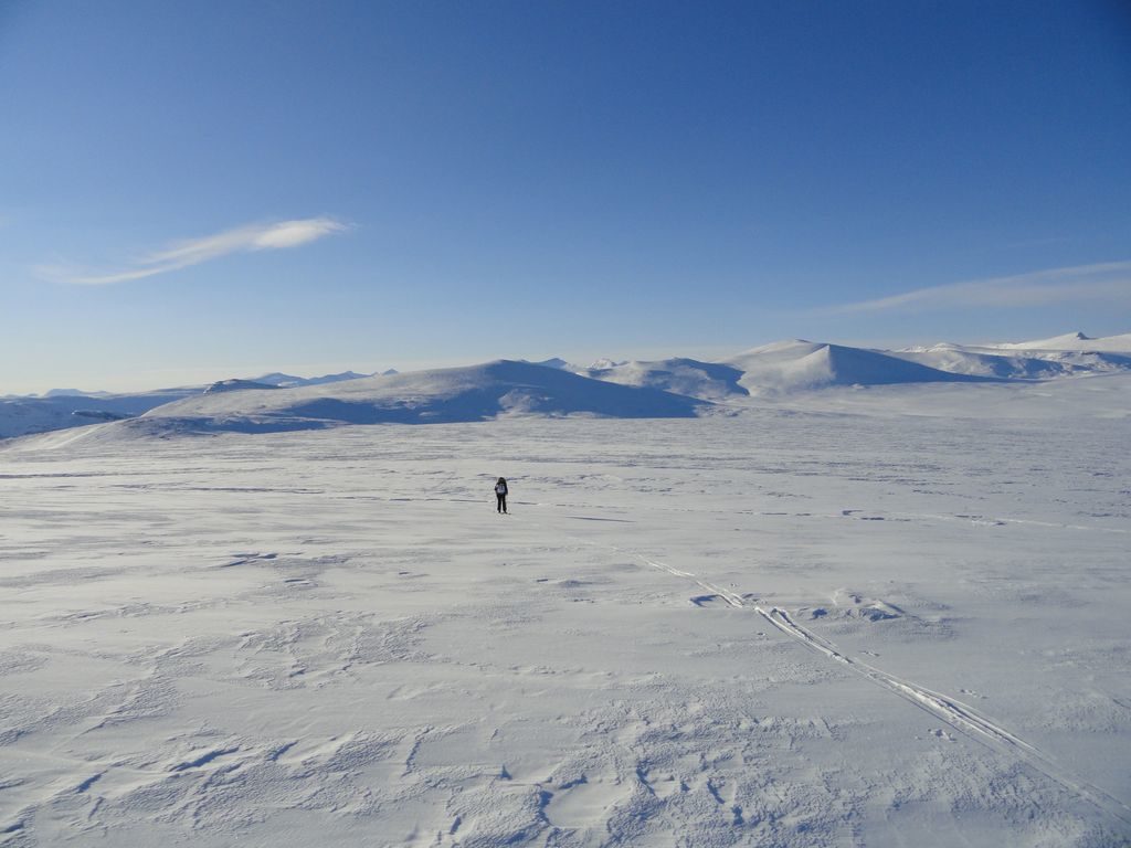
1.10PM, frozen, lets’ ski again, but we decided not to go on towards Skierffe, too long, and we decided ourself for a easier top on the way back. Endless plateau with the high Sarek peaks in the background. We’ll reach our top “Doaresoajvve” (no misspelling, I swear!) at 1083m. A 360° view all around!
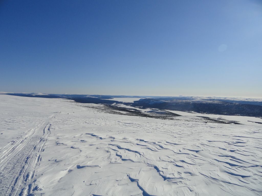
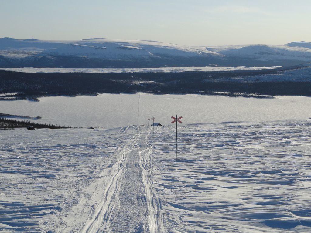
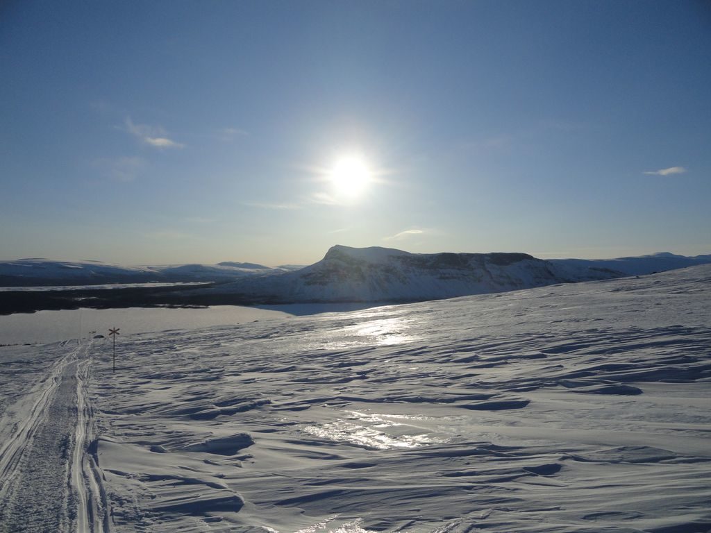
What’s left of the day is 600m downhill to reach the cottages, with those crazy Nordic skis (almost the same as cross country skis, not bound behind, and very unstable (or was it just us ?)). Passing between two drifts, down to the marked trail where we left it this morning. We lost the fall count at that time, for both characters. An outstanding way down! The trail is going straight down to the lake, very steep, and as large as a snow scooter track. The path alignment is exactly the same as the one we’ll take tomorrow morning on the next lake (cf. picture below). Impossible to brake and too steep not to. Only solution, off-track in the forest, in 40-50 cm powder snow, between the pines, with the sunset red light all around.
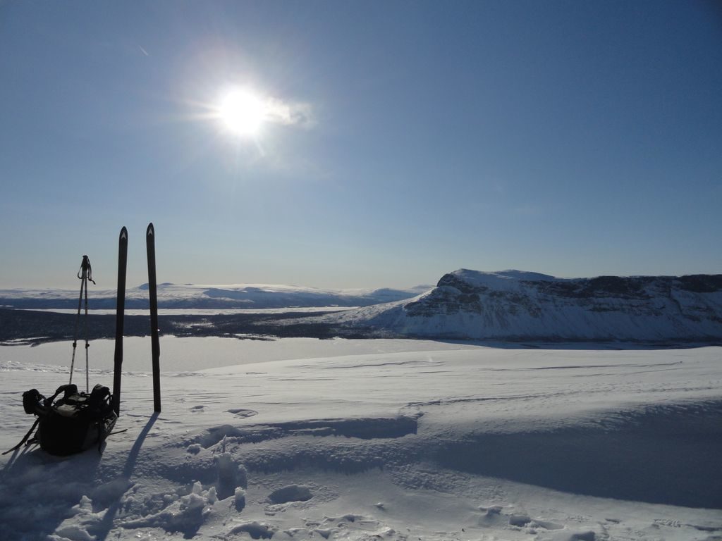
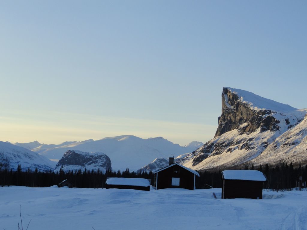
At the end of the slope, we get a perfect view on Skierffe from below. A bit bitter, but it will be for next time!
We found back the path along the lake for the last kilometer towards the cottages, last lights of the day, just enough time to take the last pictures, get water and chop a bit of wood. The dogs are here, they took another way, because of the last downhill slope, too steep for the sledges. Small talk with the other skiers, they took yet another solution for the slope, they walked down with the skis on the shoulders. They have no idea what they have missed!
All in all, 21km on the GPS, 450m up and 600m down, tough way down, and tomorrow is the longest stage, with some unexpected up and down on what’s usually flat in winter (and summer also, actually…).